
Geotechnical assessments are carried out to collect information on the grounds’ physical properties for a range of applications. These applications include site sustainability research and structure repairs. With geotechnical assessments, project managers can identify problems and avoid costly delays in building, development, and engineering projects. The issues this étude géotechnique can disclose include those that result from the soft or weak ground, landslides, sinkholes, and more. Also, geotechnical investigations are used for measuring factors like thermalresistance of soils or backfill materials that are used for underground cables and pipelines, underground storage facilities, and waste disposal.
What Do Geotechnical Assessments Cover?
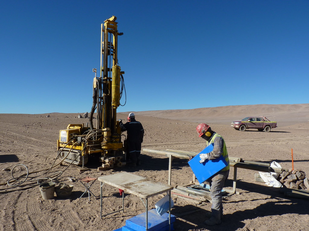
Geotechnical engineers perform geotechnical assessments that cover various kinds of investigations. They may just walk around a site to observe physical conditions or perform geological mapping and photogrammetry. To evaluate soil conditions below the surface, they explore the subsurface using techniques like sampling, trenching, test pits, lab or on-site testing, and boring. These techniques are also used for soil contamination that might impact the proposed development.
An Important Part of Geotechnical Assessments
Any geotechnical assessment should involve understanding the engineering proposed for the site. It is imperative to assess the sustainability of the site as early as possible in the timeline of the project. This will determine whether the site is fit for its purpose in its current state or if it requires remedial work. This kind of assessment is often performed before the land is bought. Its scope may include possible risks and budgets.
Knowing If a Site Needs a Geotechnical Assessment
A geotechnical assessment is usually needed when evaluating a site for development. It is meant to identify the kind of soilpresent below the ground. With this study, the best foundation for the structure will be determined. Investigators will look for the soil and lithology types to evaluate their reaction to the proposed design.
Soil and Rock Characterization
When carrying a site assessment, investigators look to accomplish the following:
- Classifying lithology. Site lithology can be determined by gathering soil and rock samples from various depth intervals. In some instances, a deep soil boring with continuous sampling is required.
- Classifying the soil. Soil can be sand, silt, or clay. Soil type must be classified since the permeability will affect the remedial approach. For instance, a chemical injection cannot be performed if clay is present beneath the ground since it will not move through this kind of soil.